


On November 5, 1991, tropical storm Uring caused landslides that dammed a river and ultimately led to catastrophic flooding of Ormoc City on the island of Leyte, Philippines. (See this family’s site for more details and photos.) There were nearly 5000 dead (a few of which can be seen in the photos linked above) and 3000 missing–now also assumed dead.
The November 2013 Typhoon Haiyan damage to both Ormoc and especially Tacloban, cities I have visited, brought back the memories of this trip I made 21 years ago. I thought I’d share a few photos.
In March of 1992, I took a trip to the Philippines. I went alone to become immersed in the culture as well as I could. After spending time in Manila and Cebu City, I flew to Ormoc, site of the disaster less than six months earlier. I was given some first-hand accounts of the devastation, descriptions of the bodies stacked five or six high along the sea walls, and shown the damage, some of which I captured on film. This was before digital cameras, so I was very selective in my shots, getting only 36 per roll of film.
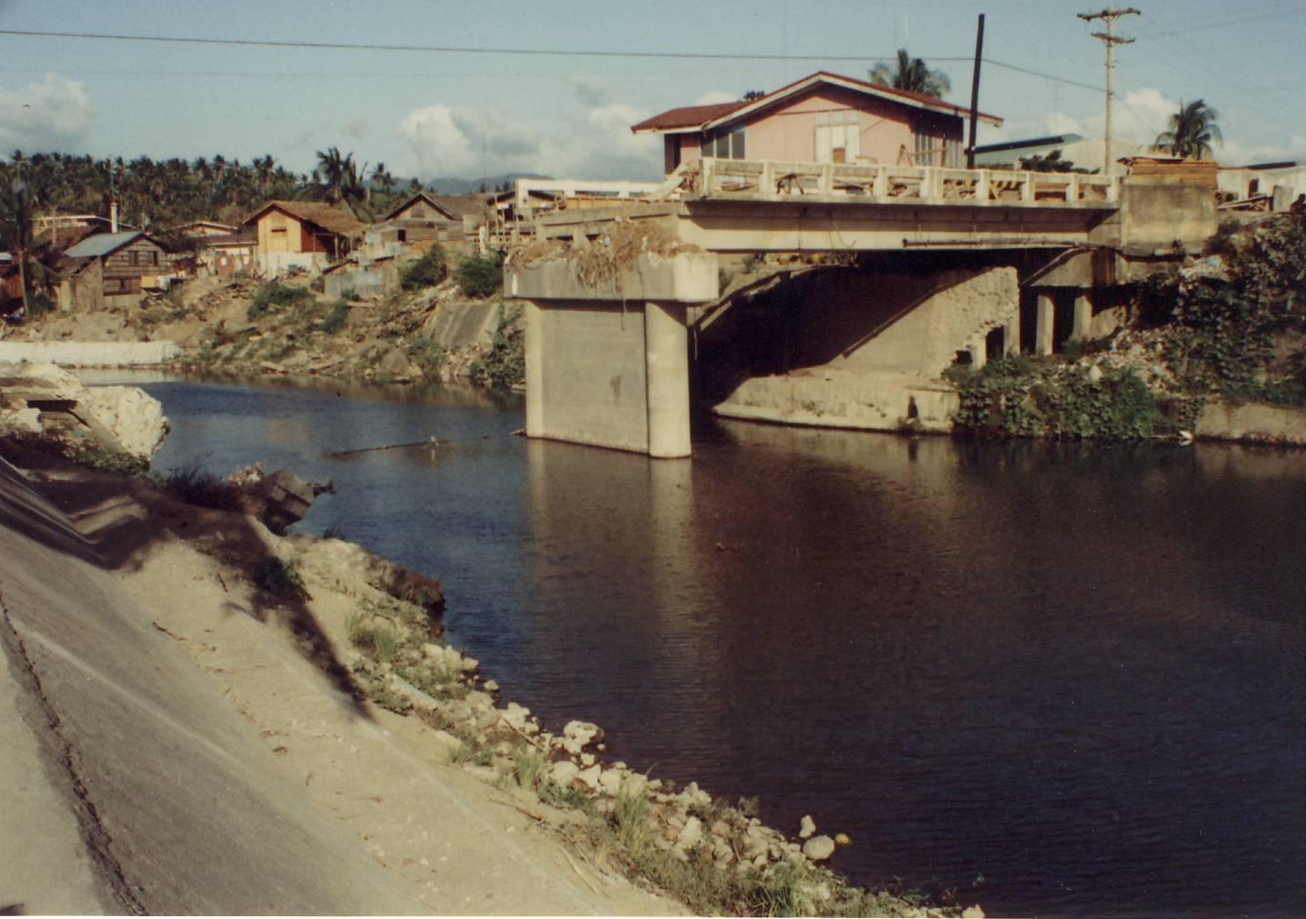
March 1992 – Washed-out bridge in Ormoc City, Philippines. Damage from Tropical Storm Uring November 1991.
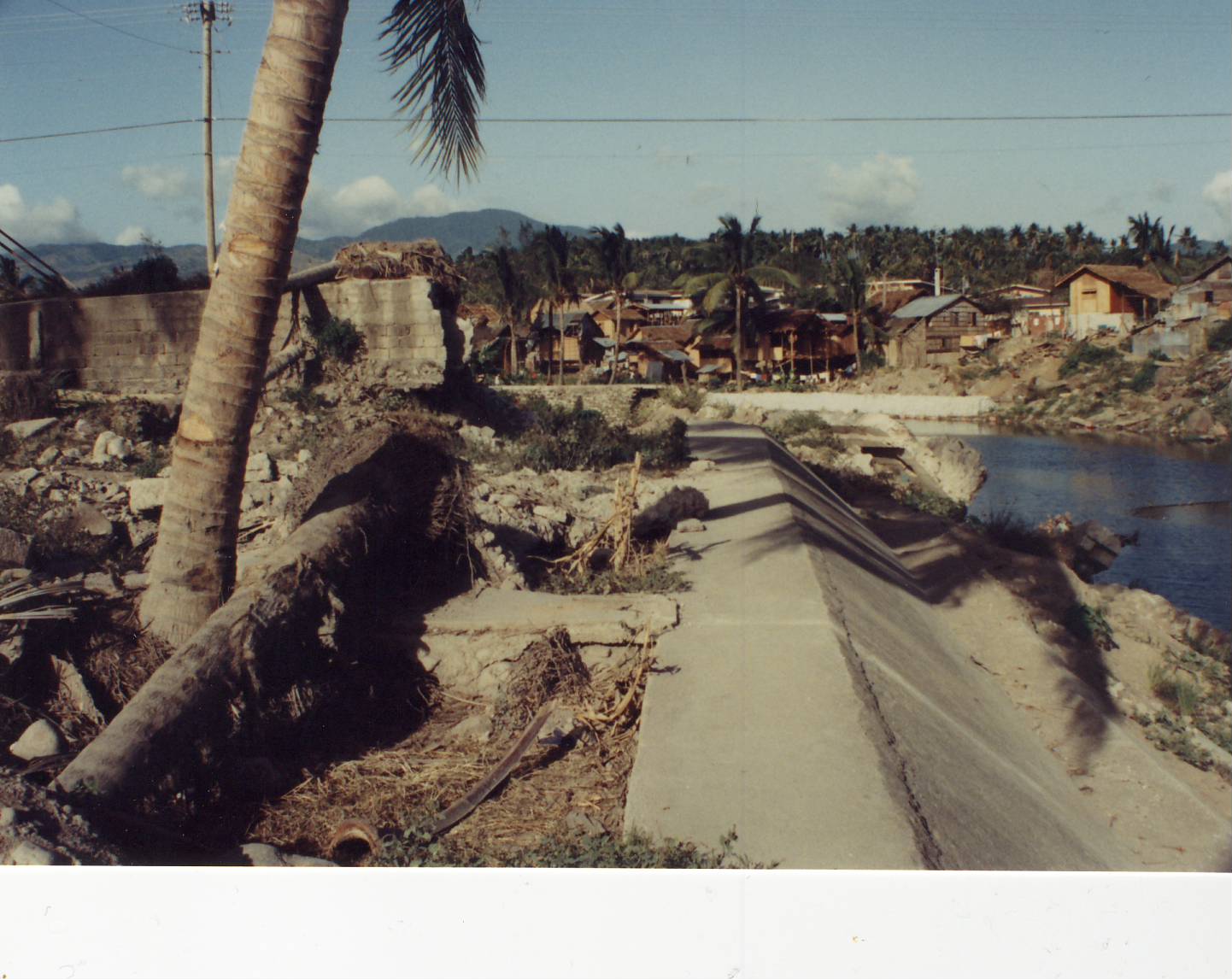
more damage to Ormoc City photographed in March 1992.
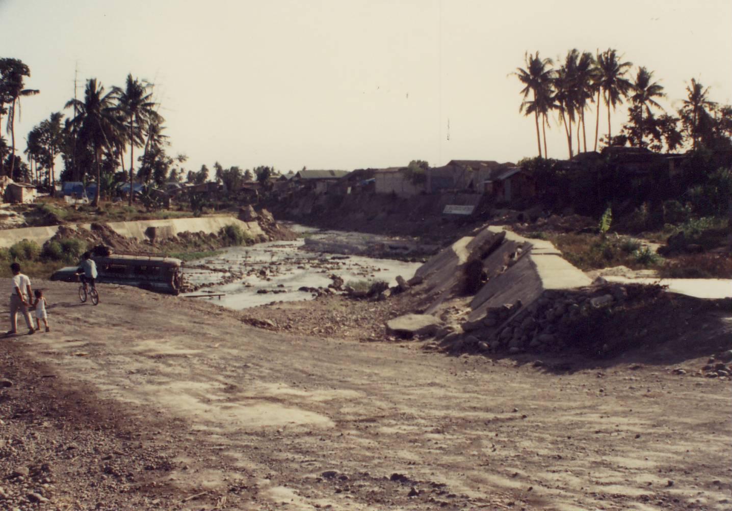
More results of the November 1991 flooding in Ormoc City, photographed in March 1992.
Ormoc was still struggling when I visited, though the hotel I used was pleasant enough. From Ormoc, I took a bus across the island along an old US Army road. The destination was Tacloban. I wanted to visit Red Beach at Palo, where Douglas MacArthur “returned.”
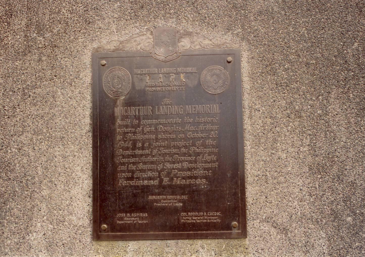
MacArthur landing memorial – Red Beach at Palo. photographed in March 1992.

MacArthur and friends in statue form. Red Beach at Palo, near Tacloban, Leyte.
While there, some people took me by jeep across the San Juanico Bridge. It is the longest bridge in the Philippines spanning a body of water, the San Juanico Strait between the islands of Leyte and Samar. We rode across and I was not allowed out of the jeep due to NPA activity on Samar. NPA stands for New Peoples’ Army, the local communist insurgents. “They will cut you.” (Gesture finger across the throat.) We spent less than 30 seconds on Samar–long enough to turn around, and immediately went back to Leyte.
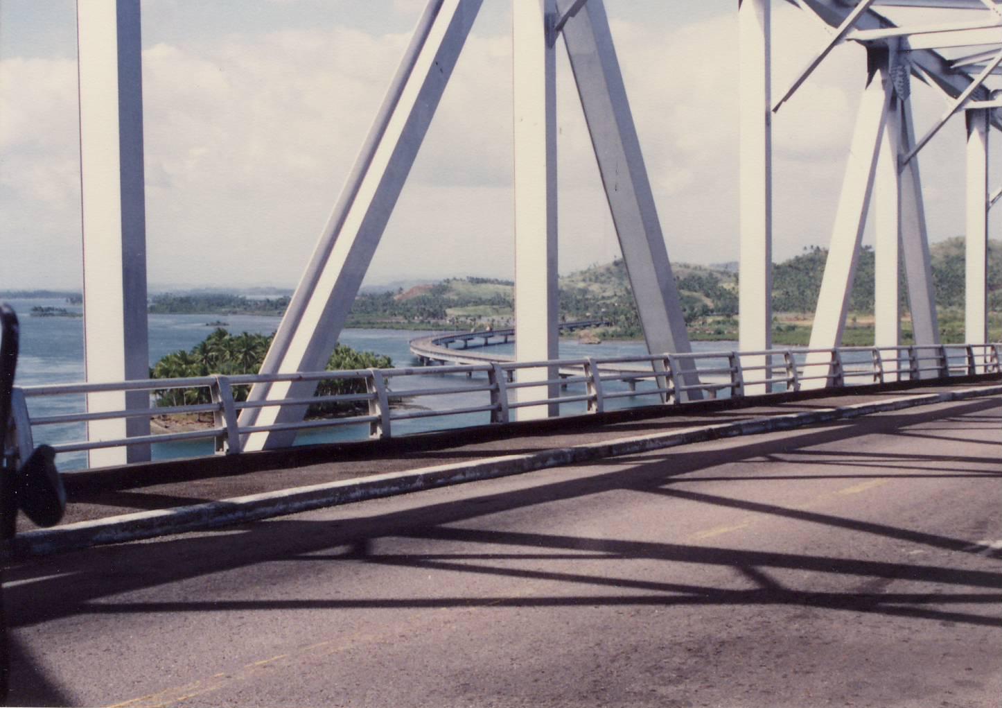
Somewhere in the middle of the San Juanico Bridge Leyte/Samar Philippines, March 1992.
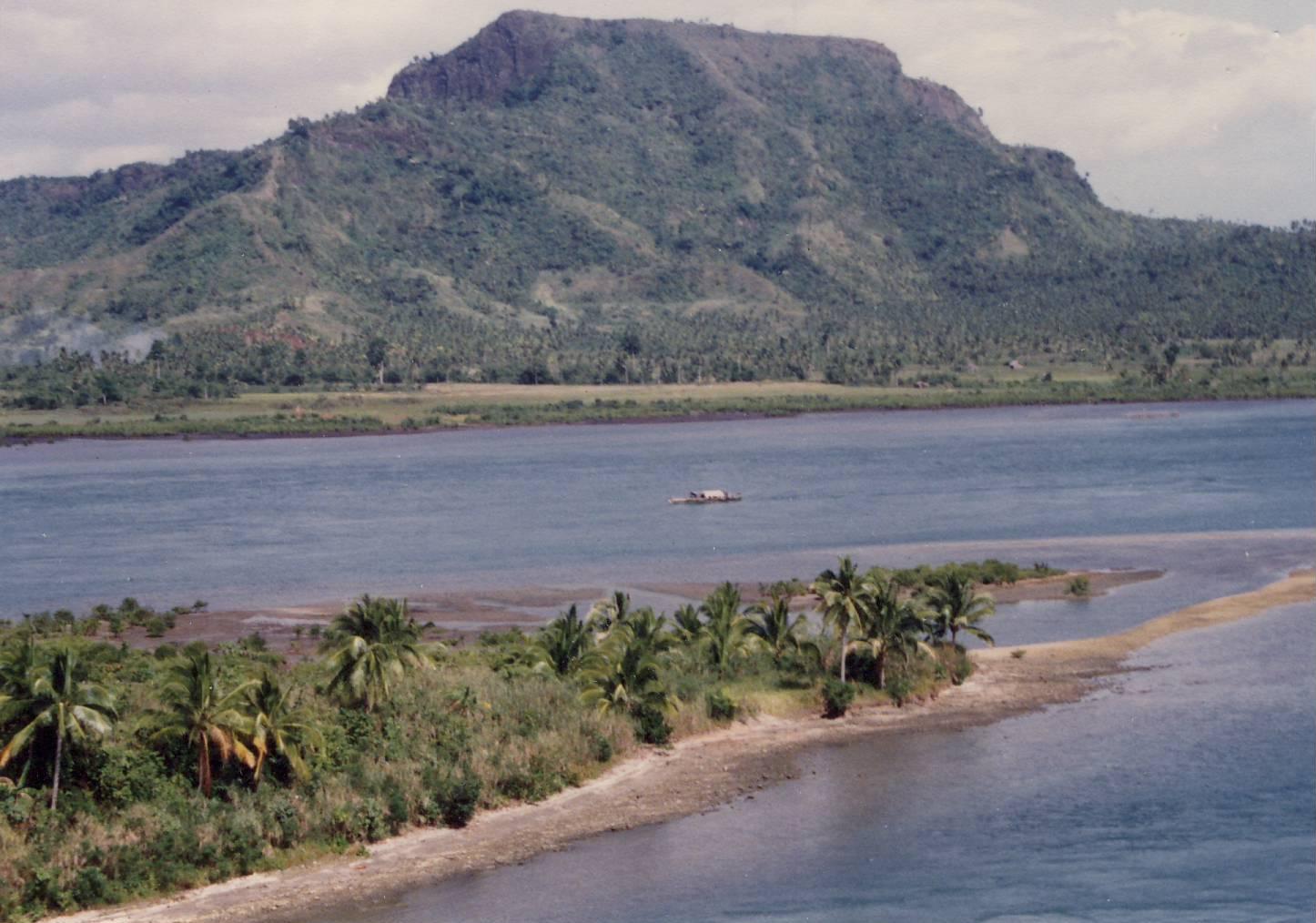
View from the San Juanico Bridge, probably looking toward Leyte. March 1992.
I took the bus back to Ormoc and then flew to Mindanao. I haven’t dug up photos from that leg of the trip, but here is one of a much younger me with a metal carabao, I think in Rizal Park, Manila.
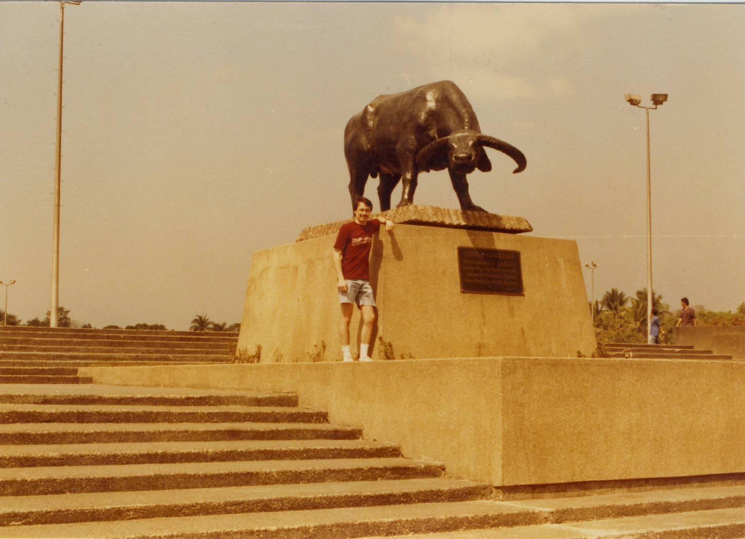
A much younger me in 1992 with a metal carabao. Rizal Park, Manila.
I had also planned to visit Bohol and see the Chocolate Hills, but I had a bad feeling about it. There were plenty of NPA on Bohol as well, so I used a little surge in my allergies as an excuse to change my plans.
